 Road access to North Cascades National Park is extremely limited. The North Cascades Highway doesn’t actually travel through the park; rather it travels through the Ross Lake National Recreation Area. The road south from Canada to Hozomeen also only enters Ross Lake National Recreation Area; besides it is currently closed. There is a road from Stehekin that extends a couple of miles into the park, but of course, Stehekin has no road access itself. That leaves the Cascade River Road, which ends at the Cascade Pass trailhead. In my opinion, the view from the end of the road is amazing; the view from Cascade Pass is better (in their description of the trail to Cascade Pass, the Washington Trails Association says “perhaps no other trail in the state delivers as much reward for the effort”). But if you want to go this season, you better hurry. The Park Service announced yesterday the road will close five miles from the trailhead starting tomorrow for a minimum of two weeks. Following that, there is no telling when it might close due to snow.
I had the opportunity to hike to Cascade Pass last week when in the area for work. My business done at noon, I drove up the Cascade River Road and into the park. The trail is 3.6 miles one way and climbs about 1,700 feet. It starts out of the parking lot with 31 switchbacks, climbing through forest with occasional “peek-a-boo” views of the surrounding mountains. But with less than a mile to go, past the last switchback, the trail levels out and comes out of the trees for impressive views of glaciers, fields, mountains, and valleys. Wildlife sightings are common – a fellow hiker reported a bear near the trailhead, though I did not see it.
For continued views, the trail extends from the pass up Sahale Arm. For the atheltic hiker, the trail east down out of the pass continues about 30 miles, all the way to the aforementioned town of Stehekin. And for the truly adventurous, the Ptarmigan Traverse (a high backcountry route) climbs over the mountains south of the pass (some of my photo buddies have done this route and brought back amazing pictures). For me, at least on this day, I chose to travel up the Sahale Arm trail mile or so before turning around to get back to the car before sunset.
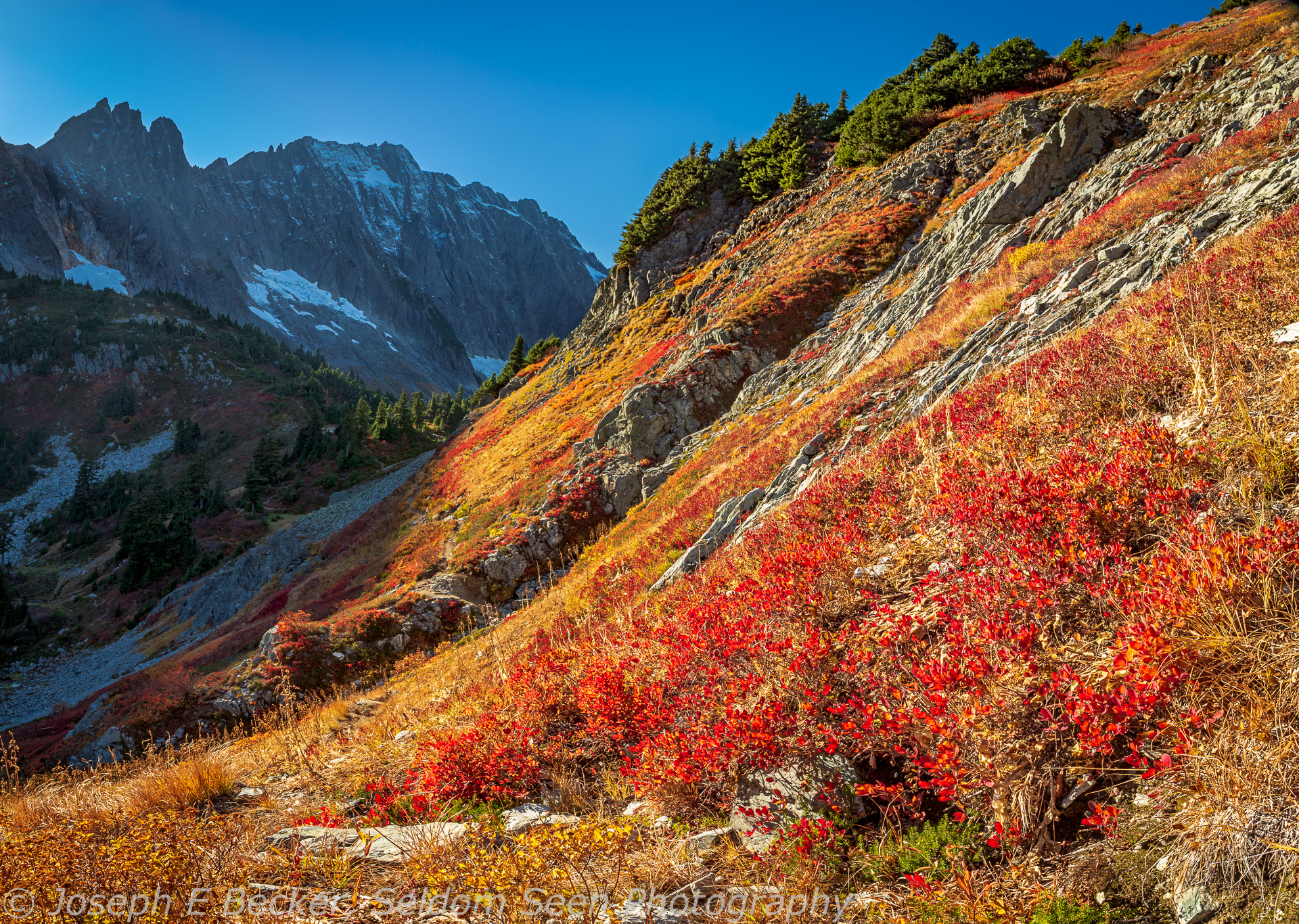
The fall colors were amazing, even if slightly past their peak on my hike, as I think you can attest by the accompanying photos. The featured shot above is a 3-shot vertical panorama looking back at Cascade Pass from the Sahale Arm trail. Captions explain the other photos (below).


Leave a Reply